In recent years, the Kingdom of Saudi Arabia has seen a significant focus on environmental sustainability and biodiversity conservation. Multiple well funded greening and restoration projects are progressing in urban and natural areas. Among the various ecological challenges faced by the country, the spread of invasive plant species poses a considerable threat. These plants, often introduced unintentionally, can disrupt local ecosystems, outcompete native species, and ultimately lead to ecological imbalance. In this blog post, we will explore the potential distribution of invasive plants across Saudi Arabia, leveraging data from the Global Biodiversity Information Facility (GBIF) and species distribution modeling techniques.
Highlights:
- Our species distribution model maps reveal potential hotspots for invasive plants in Saudi Arabia, particularly along the western coast and parts of the eastern province, due to favorable climatic and soil conditions and human activities.
- Vulnerable ecosystems, such as oases and wadis, are especially at risk.
- With rising temperatures and changing precipitation patterns, climate change is expected to further exacerbate the spread of these invasive species, highlighting the need for proactive measures.
Understanding Invasive Species in Saudi Arabia
Invasive species are non-native organisms that, when introduced to a new environment, can spread rapidly and cause significant ecological harm. In Saudi Arabia, the National Center for Vegetation Cover (NCVC) has classified several plant species as invasive, highlighting the need for effective management and prevention strategies. These invasive plants can thrive in diverse habitats, from arid deserts to coastal regions, making their management particularly challenging.
The Role of Biodiversity Data
Comprehensive biodiversity data is crucial for tackling the issue of invasive species. The Global Biodiversity Information Facility (GBIF) is an international network and research infrastructure providing access to a vast biodiversity data repository. By tapping into this resource, researchers and policymakers can gain valuable insights into the distribution patterns of invasive species.
For our analysis, we downloaded biodiversity data from GBIF, focusing on the 67 invasive plant species identified by the NCVC. This dataset includes records of species occurrences, which serve as the foundation for our distribution modelling.
Modelling the Potential Distribution: The MaxEnt Approach
To predict the potential distribution of invasive plants in Saudi Arabia, we employed the Maximum Entropy (MaxEnt) modelling technique. MaxEnt is a powerful tool for species distribution modelling, especially when dealing with presence-only data, like the occurrence records from GBIF. It estimates the most probable distribution of a species based on environmental variables and known occurrence points.
In our study, we meticulously acquired global occurrence records for 67 of these species (totalling 2,393,411 records) from GBIF.org (GBIF.Org User 2024). After a thorough process of removing duplicate entries, absence records, and records with missing or erroneous location data, 1,188,272 records remained. This rigorous data preparation process ensures the accuracy and reliability of our findings. We thinned the data to include only one record per 1 km² grid cell to ensure spatial accuracy. Environmental variables for our model included soil parameters (bulk soil density in g/cm³, clay content percentage, pH CaCl2, organic carbon percentage) and climatic factors (annual mean temperature, maximum temperature of the warmest month, mean annual precipitation, precipitation of the warmest quarter, precipitation of the coldest quarter) (Hengl et al. 2017; Fick and Hijmans 2017; Hageer et al. 2017). We reserved 20% of the records as testing data and generated 10,000 background records for the modelling process. The species distribution model utilised native and invaded range occurrence data to predict potential distributions within KSA.
Unveiling the Potential Distribution Maps
The resulting maps from our MaxEnt model reveal fascinating insights into the potential spread of invasive plants in Saudi Arabia. Here are some key observations:
- Hotspots of Invasion: Certain regions, particularly along the western coast and parts of the eastern province, show high probabilities of invasive plant presence. These areas are hotspots for invasion, characterised by favourable climatic and soil conditions and human activities. We observe that certain wadi soil types and mountainous regions are more favourable. Also, agricultural areas have been selected for fertile soils with more organic matter and water availability.

- Vulnerable Ecosystems: The model indicates that delicate ecosystems, such as oases, and wadis, are particularly vulnerable to invasion. These regions provide suitable habitats and resources for invasive plants to establish and spread.
- Impact of Climate Change: Climate change plays a significant role in shaping the distribution of invasive species. The model suggests that rising temperatures and changing precipitation patterns could further exacerbate the spread of these plants, underscoring the need for proactive measures.
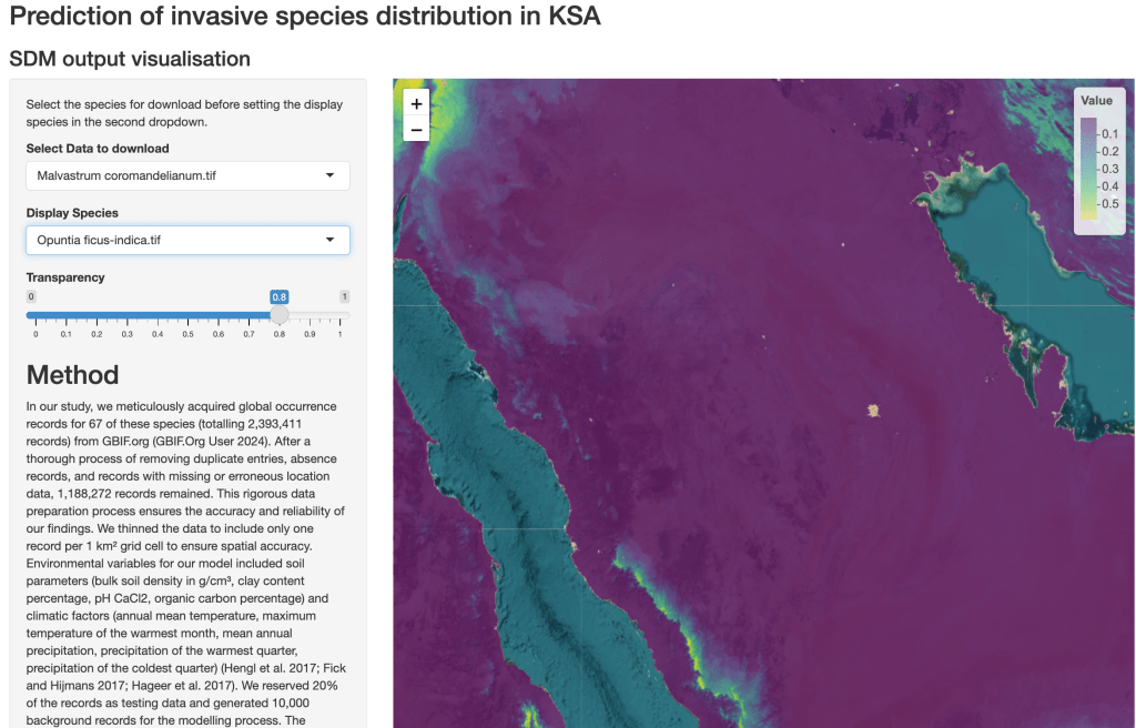
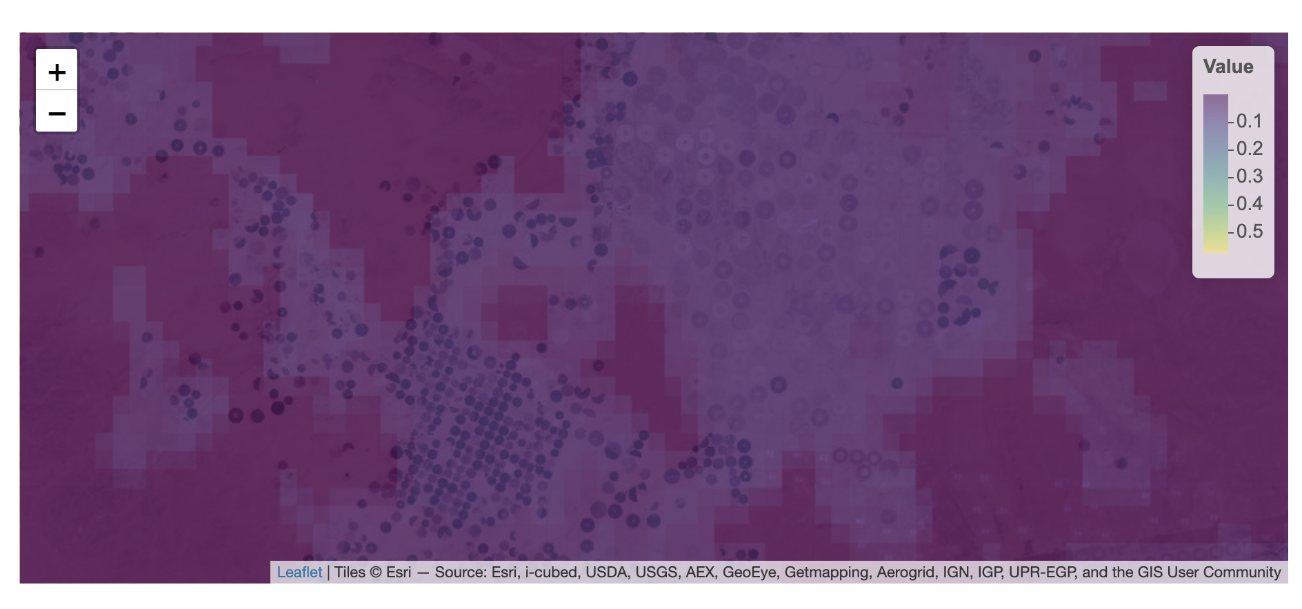
An interactive map for 67 species of concern shows the habitat suitability from 0 to 1. https://um1s0p-philipp-robeck.shinyapps.io/Vis_SDM/ Several species, such as Lantana camara and Prosopis juliflora, are widely recognised for their economic uses (horticulture, fodder), likely contributing to their widespread distribution and naturalisation in KSA.
The Importance of Proactive Management
Our analysis revealed that more than 1% (19,271.34 km²) of Saudi Arabia’s territory is suitable for twelve invasive plant species. Among these, six species find suitable habitats in more than 5% (96,356.68 km²) of the country’s territory. The provinces along the Asir mountain range (Makkah, Baha, Asir) exhibit higher suitability for the 67 invaders, attributed to the suitable soil conditions and lower temperatures found at higher elevations. The six species with the largest suitable habitats include Heliotropium curassavicum and Sesuvium revolutifolium known for its adaptability to saline soils and can often be found in coastal regions and salt flats, amd Trianthema portulacastrum common in disturbed soils and agricultural lands and areas with periodic flooding. In addition Cenchrus setigerus, a grass species well-suited to arid environments, often dominating rangelands and pastures due to its drought resistance. Prosopis juliflora and koelziana known for aggressive spread, this tree species can outcompete native vegetation, capable of forming dense thickets that disrupt local ecosystems.
The insights gained from our distribution modeling underscore the urgent need for proactive management strategies to combat the spread of invasive plants in Saudi Arabia. Here are some recommended actions:
1. Early Detection and Rapid Response: Implementing monitoring systems to detect invasive species early can prevent their establishment and spread. Rapid response teams can then take swift action to eradicate or control the invasives.
2. Public Awareness and Education: Raising awareness among the public about the dangers of invasive species and promoting responsible practices can significantly reduce the risk of introduction and spread.
3. Restoration of Native Vegetation: Restoring native vegetation in affected areas can help rebuild resilient ecosystems and reduce the competitive advantage of invasive plants.
4. Research and Collaboration: Continued research and collaboration between local and international organizations are essential to stay ahead of the invasive species threat. Sharing data, knowledge, and resources can enhance our collective ability to address this challenge.
Conclusion
Our MaxEnt model reveals the potential distribution of invasive plants in Saudi Arabia, highlighting the pressing need for concerted efforts to protect the country’s biodiversity. By leveraging biodiversity data and advanced modelling techniques, we can gain valuable insights into the spread of invasive species and take proactive measures to mitigate their impact.
However, the one-size-fits-all approach has opportunities for improvement! Adding more high-quality biodiversity data from local databases for training would improve the output. Incorporating habitat characteristics, species-specific climate, and soil variables would further nuance the distribution maps.
In conclusion, the fight against invasive plants is a crucial component of Saudi Arabia’s broader environmental conservation efforts. We can safeguard the kingdom’s unique ecosystems with sustained commitment and collaboration for future generations. Let us join hands in this endeavor to ensure a greener and more sustainable future for Saudi Arabia.
References
Photo by Leo_Visions on Unsplash and title borrowed from a science paper.

Leave a comment